National Weather Service United States Department of Commerce
Click a location below for detailed forecast.

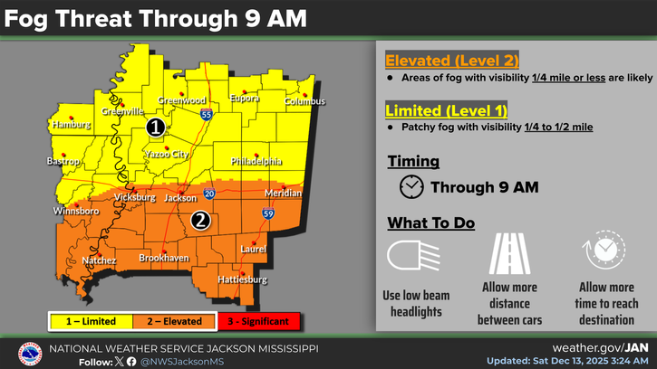
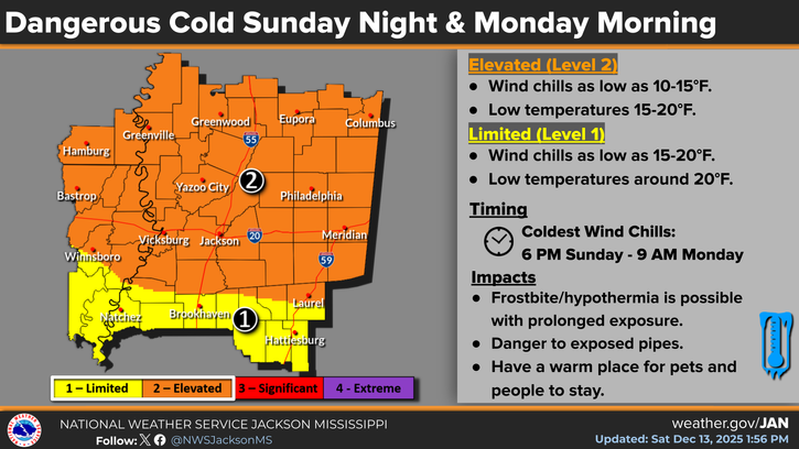
Last Map Update: Sun, May 11, 2025 at 5:44:21 pm CDT

Localized flash flooding will be possible over north central into eastern Mississippi from late this afternoon through much of tonight. Locally heavy rainfall of 2 to 3 inches could fall in a short duration. The rapid run-off could result in flooding of low-lying areas, creeks, and streams.
Isolated severe thunderstorms capable of producing damaging wind gusts and hail to the size of quarters will be possible this afternoon and evening.


SAFE Page Briefing Probabilistic Graphics Past Weather Events Precip Maps Weather History
SAFE Page Briefing Probabilistic Graphics Past Events Recent Rainfall Weather History
Forecast Discussion
Gridded Forecast Hourly Forecast Forecast Discussion Local Climate Tornado Database Submit Storm Report
    Be Prepared Estar Preparado    
    Be Prepared Estar Preparado